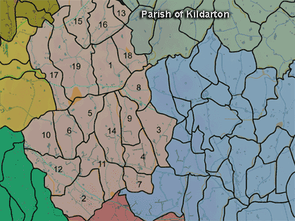
The townland of Tirnascobe is in the parish of Kildarton in Armagh County. It is labelled number 19 on the map.
The Environment and Heritage Service Sites and Monuments Record (2002) notes the following in this townland:
Rath of the Early Christian Period
SMR NO: ARM 012:011
GRIDREF: H91124602
CONDITION: TRACES ONLY
"The site has been damaged by agriculture but its form is still visible. A slightly domed, roughly circular platform measuring 42m N-S x 39m E-W is defined on the S & E by a shallow scarp which falls c.O.9m to the surrounding ground. The height diminishes towards the uphill side on the SW. A hedge boundary has perserved the perimeter of the N & W and there are vestiges of a surrounding bank c.2m wide x 0.4m high and an overgrown ditch c.4m wide & O.9m deep but this has been deepened recently.
BIBLIOGRAPHY: PATERSON, T.G.F NOTES, VOL. 135."Enclosure of the Early Christian Period
SMR NO: ARM 012:012
GRIDREF: H91384572
CONDITION: NO VISIBLE REMAINS
"The OS 6Ó map of 1835 marks a circular 'Fort' c.40m in diameter on a slight eminence above a small stream to the W. A road curves around the N side but otherwise no trace survives.
BIBLIOGRAPHY: PATERSON, T.G.F. NOTES, VOL.135.""Mount Dobbin", an enclosure, possibly a rath, possibly of the Early Christian Period.
SMR NO: ARM 012:030
GRIDREF: H906470
CONDITION: NO VISIBLE REMAINS
"The OS 6” map of 1835 records a small circular "Fort" c.25m in diameter near the summit of a small drumlin. Nothing now survives, and a concrete cattle yard occupies the area of the interior."An Ecclesiastical Site, that had a church, enclosure and graveyard, of uncertain date and possibly an Early Christian rath.
SMR NO: ARM 012:039
GRIDREF: H91414478
CONDITION: SOME REMAINS
"A circular enclosure 29m diam. is surrounded by a bank up to 3m wide and 0.5m above the interior. There is much stone on the E & W sides, but this may be from field clearance. The interior is full of graves, the latest dated to 1912. The N part of the interior is level and slightly raised especially on the E & W where it stands 1.3m above the external ground level. The monument is surrounded by a ditch up to 2m wide, 1 .2m deep below the interior; 0.4m below the outer ground level. See SM7 file for details.
BIBLIOGRAPHY:
GLANCY, M. SEANCHAS ARDMHACHA II, NO.1, 1956, 78
LESLIE, 1911, 321
PATERSON, T.G.F. NOTES, VOL.1351
ROGERS, 1961, 51-2
STOKES, 1887, 1, 232-3."
Paterson (Armachiana, Vol. 16, p.26) notes:
PRONI records: OS/6/2/12/1 (Surveyed 1835. Engraved 1835.); OS/6/2/12/2 (Surveyed 1835. Revised 1860. Engraved 1860 (Stat file copy).); OS/6/2/12/3 (Not Received.); OS/6/2/12/4 (Surveyed 1835. Revised 1905-06. Reprinted 1931-1947. Published 1931 with mss markings in red and stamped references 2566, 2567, 2573.); OS/6/2/12/5 (Surveyed 1906. Revised 1948. Levelled 1888 and 1906. Levels revised 1949. Published 1953. (2 copies) - 1 being reprint 1953, 56, 61).); D.291/3/24 (Map [Patterson collection].); VAL/1B/224 (1st valuation records.); VAL/12B/10/25A, VAL/12B/10/25B, VAL/12B/10/25C, VAL/12B/10/25D, VAL/12B/10/25E (Valuation annual revision list.); VAL/2B/2/22C 1862 (Griffith valuation list.C 1862).

