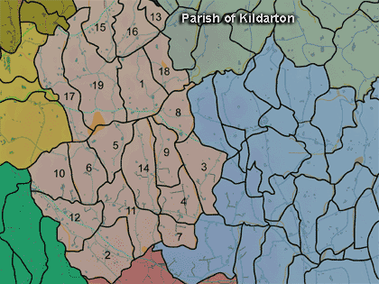
The townland of Mullanasilla is in the parish of Kildarton in Armagh County. It is labelled number 16 on the map.
Paterson (Armachiana, Vol. 16, p.25) notes:
Mullansilla. "The summit of the willows". Mullan is the diminutive of Mullach ['top' or 'summit'] and is generally applied to a low and gently sloping hill. Saileach, now anglicised as 'sillagh' denotes a place where sallows or willows grew in some profusion. Both words occur in other combinations in the county and Mullan appears in one instance in its simple form.
The Environment and Heritage Service Sites and Monuments Record (2002) notes the following in this townland:
A large tree ring of the 18th or 19th Centuries in an enclosure of uncertain period
SMR NO: ARM 012:028
GRIDREF: H91754694
CONDITION: SOME REMAINS
"This is a large tree ring, planted very closely with mature conifers. It comprises a steep faced platform with a slight outer ditch 2m wide and 0.6m deep. The platform stands 1.4m above the surrounding ground level."An enclosure of uncertain period, possible an Early Christian rath.
SMR NO: ARM 012:029
GRIDREF: H92164673
CONDITION: TRACES ONLY
"Within the small field associated witha deserted steading on a gentle NE- facing slope. The site of a small circular "Fort" is marked on an unpublished OS 6” map of 1860, but scarcely any remains are now recognisable. A slight curve in the track may indicate the perimeter on the W, and a shallow scarp in the fields to the E of the track may also reflect the outline of the site.Rath of the Early Christian Period.
SMR NO: ARM 012:037
GRIDREF: H91874738
CONDITION: TRACES ONLY
"In cultivated ground on the top of a drumlin. The site has been almost completely obliterated, and all that remains is a low, level, roughly circular platform raised 0.4-1m above the surrounding ground. Only a short length of the NW side is clearly defined, preserved below a hedge boundary. Here, a ditch, 2.75m wide & 0.9m deep can also be recognised, but this may have been recently re-cut. The SW perimeter is marked by a slight scarp, but the E side no longer survives. It is c.43m in diam. N-W."
PRONI records: D.821 (Rent account re land, Wylie family.); OS/6/2/12/1 (Surveyed 1835. Engraved 1835.); OS/6/2/12/2 (Surveyed 1835. Revised 1860. Engraved 1860 (Stat file copy).); OS/6/2/12/3 (Not Received.); OS/6/2/12/4 (Surveyed 1835. Revised 1905-06. Reprinted 1931-1947. Published 1931 with mss markings in red and stamped references 2566, 2567, 2573.); OS/6/2/12/5 (Surveyed 1906. Revised 1948. Levelled 1888 and 1906. Levels revised 1949. Published 1953. (2 copies) - 1 being reprint 1953, 56, 61).); OS/6/2/13/1 (Surveyed 1834-35. Engraved 1835.); OS/6/2/13/2 (Surveyed 1834-35. Revised 1860. Engraved 1863 (Stat file copy).); OS/6/2/13/3 (Surveyed 1834-35. Revised 1905-06. Published 1930.); OS/6/2/13/4 (Surveyed 1905-06. Revised 1954-55. Levelled 1888 and 1892 and 1902, 1905-1906. Levels part revised 1948. Published 1958. (2 copies).); VAL/1B/230 (1st valuation records.); VAL/12B/10/25A, VAL/12B/10/25B, VAL/12B/10/25C, VAL/12B/10/25D, VAL/12B/10/25E (Valuation annual revision list.); VAL/2B/2/28C (Griffith valuation list.).