 H936447
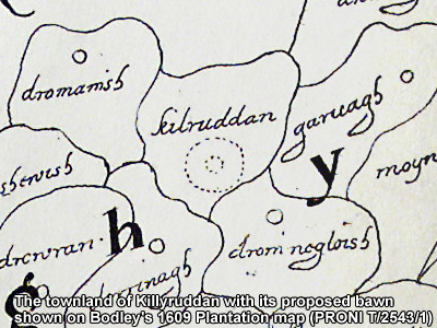
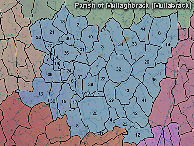
The townland of Killyruddan is in the parish of Mullaghbrack in Armagh County. It is labelled number 28 on the map.
Paterson (Armachiana, Vol. 16, p.26) notes:
The Environment and Heritage Service Sites and Monuments Record (2002) notes the following in this townland:
PRONI records: D.959/M/22B (Map by J.C. McBride.); T.1007/145, 216, 231, 234, 240, 248, 276 (Rental and maps with list of tenants.); T.1007/291/217, 225, 226, 229, 242, 245, 247, 249, 252, 256, 261, 263, 266, 275, 278, 280, 282 (Notes of rentals.); D.943/2 (Graham estate.); OS/6/2/13/1 (Surveyed 1834-35. Engraved 1835.); OS/6/2/13/2 (Surveyed 1834-35. Revised 1860. Engraved 1863 (Stat file copy).); OS/6/2/13/3 (Surveyed 1834-35. Revised 1905-06. Published 1930.); OS/6/2/13/4 (Surveyed 1905-06. Revised 1954-55. Levelled 1888 and 1892 and 1902, 1905-1906. Levels part revised 1948. Published 1958. (2 copies).); VAL/1B/29A, VAL/1B/213 (1st valuation records.); VAL/12B/10/24A, VAL/12B/10/24B, VAL/12B/10/24C, VAL/12B/10/24D (Valuation annual revision list.); VAL/2B/2/12B (Griffith valuation list.).
H936447