 H970378
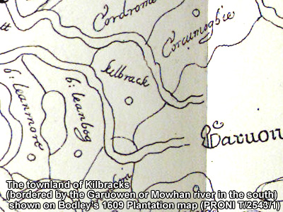
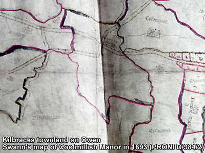
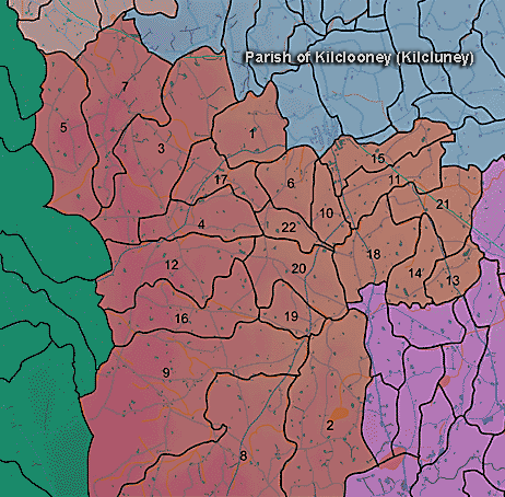
The townland of Kilbracks is in the parish of Kilclooney in Armagh County. It is labelled number 18 on the map.
Paterson (Armachiana, Vol. 16) notes:
...The root word cill is very well represented in each of the four Provinces and it is estimated that about 2,700 place names derive from it, most of them prefixed by the names of saints or founders. ...As a prefix it occurs in Killbracks (the speckled church)...etc. (p.23)
The Environment and Heritage Service Sites and Monuments Record (2002) notes the following in this townland:
Rath of the Early Christian Period.
SMR NO: ARM 017:025
GRIDREF: H97343824
CONDITION: SOME REMAINS
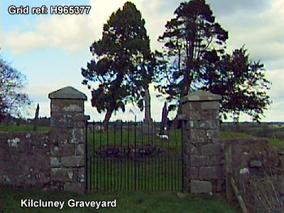
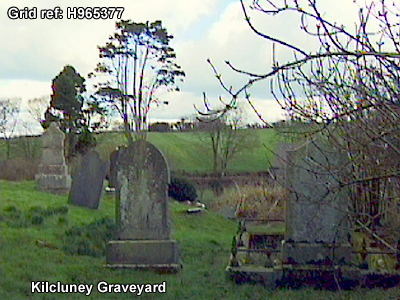
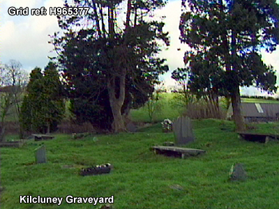
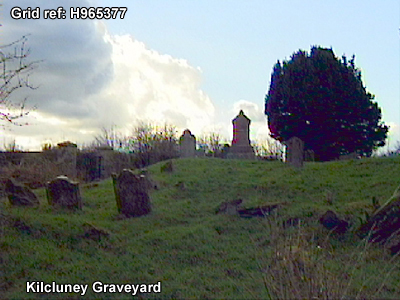
"A low circular platform 37m in diam. has been levelled out of the gently sloping hillside. The NW side has been destroyed & only a slight scarp remains. Elsewhere the perimeter is marked by a hedge & low bank, 1.8m wide x 0.5m high. Beyond this is a steep scarp. On the S side the interior is c. 1.2m above the surrounding ground but this decreases towards the N as the natural ground level rises. A short length of ditch c.3m wide survives on the SE. Most of the perimeter is circled by a road which follows the ditch."Ecclesiastical site known alternatively as GARTHFYDING, CLANCARNEY, and KILCLOONEY, dating from the Early Christian, Medieval and late-Medieval Periods.
SMR NO: ARM 017:038
GRIDREF: H96603760
The church and graveyard date to the medieval and late-medieval periods, possibly built on the site of an Early Christian church and graveyard. The Holy Well is medieval - late-medieval and may go back to the Early Christian period.
CONDITION: SOME REMAINS
"The graveyard is set above the surrounding ground level -1.6m at NE & 2m SE. A shallow silted ditch 1.8-2m wide x 0.2-0.3m deep is visible at N & W but this may be a field drain. The E graveyard interior is uneven, with much animal damage & possible flax setting areas. There are many gravestones visible including numerous unlettered ones. There is no trace of a church associated with the graveyard. The Holy Well linked with the site has been filled in and is no longer visible.
BIBLIOGRAPHY:
LESLIE, ARMAGH CLERGY & PARISHES, 1911, 163-5
MACDERMOTT, 1956, SEANCHAS ARDMHACHA PATERSON,T.G.F., UJA 1948, 126"
PRONI records: OS/6/2/17/1 (Surveyed 1835. Engraved 1835.); OS/6/2/17/2 (Surveyed 1835. Engraved 1835. Revised 1860. Engraved 1863.); OS/6/2/17/3 (Surveyed 1835. Revised 1906. Published 1908. Reprinted 1929, 1932.); OS/6/2/17/4 (Surveyed 1906. Revised 1954-5. Levelled 1889, 1892 and 1906. Published 1958 (2 copies).); VAL/1B/210A, VAL/1B/210B (1st valuation records.); VAL/12B/10/34A, VAL/12B/10/34B, VAL/12B/10/34C, VAL/12B/10/21A, VAL/12B/10/21B (Valuation annual revision list.); VAL/2B/2/9A (Griffith valuation list.).
H970378