 H951441
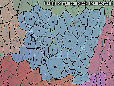
The townland of Hamiltonsbawn (or Hamilton's Bawn) is in the parish of Mullaghbrack in Armagh County. It is labelled number 26 on the map.
The village of Hamiltonsbawn was described in 1838 in the Ordnance Survey Memoirs:
"Hamiltonsbawn village, situated on the road between Richhill and Markethill at the distance of 2 1 miles from the former and 3 miles from the latter. It has 2 fairs in the year viz. on the 26th May and on the 26th November. It contains 38 cabins and 23 2-storey houses. The trades are 6 grocers and publicans, 2 carpenters, 3 shoemakers and 1 smith. There is no place of worship nor police force nor magistrate." (Ordnance Survey Memoirs 1835-38)
The 1826 Schools Commission report describes the school in the townland:
"Hamiltonsbawn - A pay school under the care of Francis White, of the Church of Ireland denomination, who was in receipt of 20l per annum. The school was conducted in a "good house" built at a cost of 80l. The school provided education for 60 scholars."
The Environment and Heritage Service Sites and Monuments Record (2002) notes the following in this townland:
BAWN of the Seventeenth Century.
SMR NO: ARM 013:014
Grid Ref: H95004430
Townland: HAMILTONSBAWN
Sitename: HAMILTON'S BAWN, HAMILTON'S RUINS
Condition: No visible remains
Built by John Hamilton in the early Seventeenth Century, and burned in 1641. It was later rebuilt and sold in 1704. It then became a barracks until the late Eighteenth Century. A map of 1705 shows a bawn with roofed buildings on 3 sides of a rectangle. See SM7 file for details.
BIBLIOGRAPHY:
1. J. R. S. A. I., XVI, 1833-4, 433
2. LEWIS, 2.1837, Vol. II, 2
3. O. S. FIELD REPORT NO.29, 7
Rath of the Early Christian Period.
SMR NO: ARM 013:026
Grid Ref: H94834480
Townland: MULLAGHBANE, Hamilton's Bawn
Condition: traces only
Vestigial traces of this site survive on a slight local eminence. It comprises a roughly circular platform c.28m in diameter. Only on the W side can traces of an original scarp be seem. The platform has a fairly flat top which is now used as a playground with swings etc.
PRONI records: D.723 (Bond re Sir Hans Hamilton to Richard Eustace of Lisburn.); D.1606/6B/6 (Map re part of estate of Earl of Gosford surveyedby William Greig and John Hill.); D.1606/6B/3 (Map and survey of Demesne of Hamiltonsbawn belonging to Hon. Sir Hans Hamilton surveyed by Mathew Black.C 1750); D.1606/6B/1 (Survey by Jo. Sloane.); T.1233 (Map.C 1750); T.1233 (Map noting tenants.C 1750); D.1606/6B/4 (Map re estate of Rt Hon. Lord Visc. Gosford surveyed by James Turner.); OS/6/2/13/1 (Surveyed 1834-35. Engraved 1835.); OS/6/2/13/2 (Surveyed 1834-35. Revised 1860. Engraved 1863 (Stat file copy).); OS/6/2/13/3 (Surveyed 1834-35. Revised 1905-06. Published 1930.); OS/6/2/13/4 (Surveyed 1905-06. Revised 1954-55. Levelled 1888 and 1892 and 1902, 1905-1906. Levels part revised 1948. Published 1958. (2 copies).); VAL/1B/213 (1st valuation records.); VAL/12B/10/24A, VAL/12B/10/24B, VAL/12B/10/24C, VAL/12B/10/24D (Valuation annual revision list.); VAL/2B/2/12A (Griffith valuation list.).
H951441


