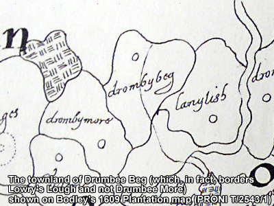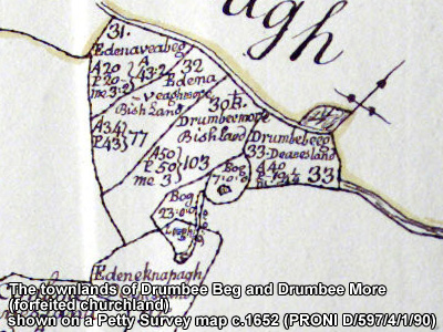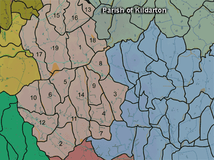
The townland of Drumbee Beg is in the parish of Kildarton in Armagh County. It is labelled number 5 on the map.
Paterson (Armachiana, Vol. 16, p.22) notes:
The Environment and Heritage Service Sites and Monuments Record (2002) notes the following in this townland:
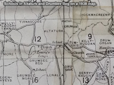
Possibly an Early Christian crannog on "Lowry's Lough"
SMR NO: ARM 012:062
GRIDREF: H91074448
CONDITION: SOME REMAINS
"An irregular island, measuring c.75m N-S x 45m E-W is shown on the OS 6” map of 1835, 1 c.40m from the S shore of Lowry's Lough. Subsequent maps indicate that the level of the lough has been raised by the construction of a small dam at the S end. The island is still. visible above the present water level, but it is now roughly circular and measures c.40m in diam. It is very overgrown and there are no indications that the feature is artificial."Possibly an Early Christian crannog on "Lowry's Lough"
SMR NO: ARM 012:063
GRIDREF: H91134456
CONDITION: NO VISIBLE REMAINS
"An island, which may be a crannog, is marked on the OS 6” map of 1835 in Lowry's Lough. The level of the lough has since been raised and the site can no longer be seen.
PRONI records: D.958 (Landed estates court rental, etc., of lands, property of Wilkin family.); D.958 (Rental, particulars and conditions of sale of lands.); D.943/2 (Graham estate.); OS/6/2/12/1 (Surveyed 1835. Engraved 1835.); OS/6/2/12/2 (Surveyed 1835. Revised 1860. Engraved 1860 (Stat file copy).); OS/6/2/12/3 (Not Received.); OS/6/2/12/4 (Surveyed 1835. Revised 1905-06. Reprinted 1931-1947. Published 1931 with mss markings in red and stamped references 2566, 2567, 2573.); OS/6/2/12/5 (Surveyed 1906. Revised 1948. Levelled 1888 and 1906. Levels revised 1949. Published 1953. (2 copies) - 1 being reprint 1953, 56, 61).); VAL/1B/211 (1st valuation records.); VAL/12B/10/29A, VAL/12B/10/29B, VAL/12B/10/29C, VAL/12B/10/29D (Valuation annual revision list.); VAL/2B/2/12B (Griffith valuation list.); D.266/356A; D.2223/32/28; D.2589/1; T.579/26 (Encumbered estates rental.3 May 1856); D.958/5 (Landed estates rental.11 July 1874).