 H937419
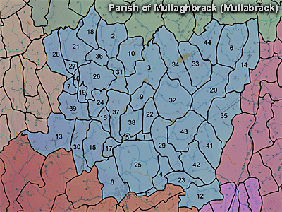
The townland of Drumachee is in the parish of Mullaghbrack in Armagh County. It is labelled number 13 on the map.
Paterson (Armachiana, Vol. 16) notes:
Drumachee. "Ridge of the way or pass". Probably derives from an ancient trackway that crossed the ridge. (p.27)
Drum (Druim) [meaning 'ridge'] is one of the most common names and figures as a prefix to about 2,400 places besides an equal number in which it is combined. (p.21)
Note that Neil McGleenon favours "the hill of the blind man" as a derivation from the Irish.
The 1826 Schools Commission report describes the school in the townland:
"Drumachee - A pay school under the care of Peter Daily, of the Roman Catholic denomination, who was in receipt of 4l per annum. The school was conducted in a cabin, built at a cost of 7l. The number of scholars is not stated."
The Environment and Heritage Service Sites and Monuments Record (2002) notes the following in this townland:
Oval cropmark enclosure of uncertain period noted on an aerial photograph.
SMR NO: ARM 017:061
GRIDREF: H93274151
CONDITION: TRACES ONLY Threats NONE APPARENT SITE DESCRIPTION: An oval enclosure c.50m x c.30m showed up on APs [aerial photographs]. It is a complete ditched feature, and could well be seen in relief - the interior is raised to a level platform. It is orientated NE/SW. It is situated at the summit of a hill and was found under grassland and rough vegetation. Not visited."
PRONI records: OS/6/2/16/1 (Surveyed 1834-35. Engraved 1835.); OS/6/2/16/2 (Surveyed 1834-35. Engraved 1835. Revised 1860. Engraved 1862.); OS/6/2/16/3 (Surveyed 1834-35. Revised 1906. Levelled 1888-89 and 1906. Published 1908. Reprint 1952, 1954.); OS/6/2/16/4 (Surveyed 1834-35. Revised 1906. Levelled 1888-89 and 1906. Published 1908. Reprint 1929.); OS/6/2/16/5 (Surveyed 1834-35. Revised 1906. Levelled 1888-89 and 1906. Published 1908. Reprint 1952, 1954 with Mss. markings in red and stamped ref. 2568.); OS/6/2/16/6 (Surveyed 1906. Revised 1955. Levelled 1906. Published 1958. (2 copies).); OS/6/2/17/1 (Surveyed 1835. Engraved 1835.); OS/6/2/17/2 (Surveyed 1835. Engraved 1835. Revised 1860. Engraved 1863.); OS/6/2/17/3 (Surveyed 1835. Revised 1906. Published 1908. Reprinted 1929, 1932.); OS/6/2/17/4 (Surveyed 1906. Revised 1954-5. Levelled 1889, 1892 and 1906. Published 1958 (2 copies).); VAL/1B/213 (1st valuation records.); VAL/12B/10/24A, VAL/12B/10/24B, VAL/12B/10/24C, VAL/12B/10/24D (Valuation annual revision list.); VAL/2B/2/12A (Griffith valuation list.).
H937419

