 H932354
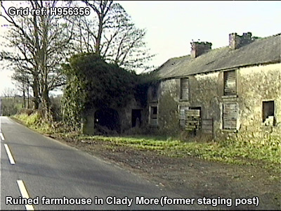
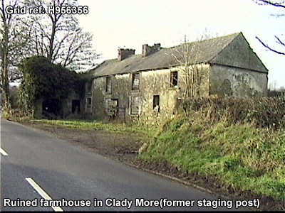
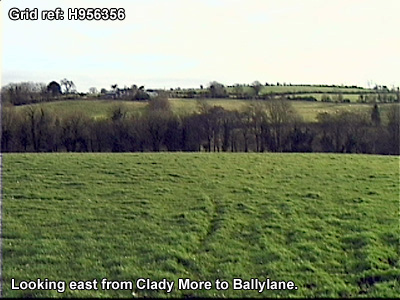
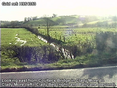
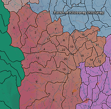
The townland of Clady More is in the parish of Kilclooney in Armagh County. It is labelled number 9 on the map.
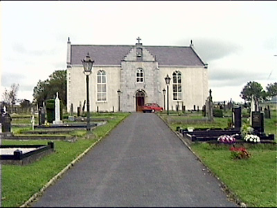
"Meeting House...Erected in 1835 in same townland [Cladymore], not yet finished, cost about 500 pounds, paid by subscription. Dimensions 60 feet by 25, 300 attend on Sunday."(Ordnance Survey Memoirs 1835-38)
The 1826 Schools Commission report describes the school in the townland:
"Collison, Cladymore - A pay school under the care of John Neill, of the Presbyterian denomination, who was in receipt of 12-25l per annum. The school was conducted in a slated house, rented at a cost of 2l. The school provided education for approximately 45 scholars."
The Environment and Heritage Service Sites and Monuments Record (2002) notes the following in this townland:
Prehistoric barrow of the Bronze Age.
SMR NO: ARM 020:012
Irish Grid Reference: H9234
Townland: CLADY MORE
Paterson recorded a penannular enclosure comprising an inner bank 1.8m wide surrounded by a ditch 0.9m deep x the same in width. This in turn was enclosed by an outer bank, also 1.8m wide which sloped down to the level of the field. Access to the interior was via a gap in the banks & ditch on E. It had apparently all the characteristics of a rath, but was only 21 m across, so it is perhaps more likely to have been a barrow of some sort. It can not now be located.
Ecclesiastical site of uncertain period.
SMR NO: ARM 021:049
Irish Grid Reference: H9333
Sitename: OLD CHURCH, KIRK FIELD, SHANKILL
Townland: CLADY MORE
CONDITION: No visible remains
Reeves wrote in 1879 that 50 years earlier there had been remains of a church on Robert Gray's farm. The graveyard had been broken up c.60 years previously (c.1819). An aged informant who died in 1909 remembered that his mother recalled funerals going to the field, but it had subsquently been cultivated. During cultivation large quantities of human bones had been found. The owner reported that he had "come upon the foundations of a building". The site can not now be located.
BIBLIOGRAPHY:
GLANCY, 1954, 88
PATERSON T. G. F. NOTES Vol. 135
REEVES, W.1879 MSS.
Enclosure of uncertain period
SMR NO: ARM 021:051
Irish Grid Reference: H9233
Sitename: COULTER'S FORTH
Townland: CLADY MORE
Paterson reported in 1930 that the site was "still traceable" on the farm of Mr James Boulter, but it can not now be located.
Enclosure of uncertain period
SMR NO: ARM 021:052
Irish Grid Reference: H9233
Sitename: MCCULLAGH'S FORT
Townland: CLADY MORE
The site was still traceable in 1930 (Paterson Mss.134) but can not now be located.
Enclosure of uncertain period
SMR NO: ARM 021:053
Irish Grid Reference: H9233
Sitename: PATRICK VALLELY'S FORT
Townland: CLADY MORE
Not precisely located.
BIBLIOGRAPHY:
PATERSON, T. G. F. NOTES Vol. 134
PRONI records: D.1644 (Expired leases of Earl of Charlemont's estate in area.); FIN.23/2/2B/1022 (Landlord Countess of Charlemont re tenant John McArdle.); OS/6/2/20/1 (Surveyed 1834-35. Engraved 1838.); OS/6/2/20/2 (Surveyed 1834-35. Engraved 1835. Revised 1860. Engraved 1864.); OS/6/2/20/3 (Surveyed 1834-5. Revised 1906. Published 1908. Reprints 1934-1957 (2 copies).); OS/6/2/20/4 (Surveyed 1834-5. Revised 1906. Published 1908. Reprints 1934-1957 (2 copies). Reprint 1934.); OS/6/2/20/5 (Surveyed 1906. Revised 1955. Levelled 1903-04 and1906. Published 1958 (2 copies).); OS/6/2/21/1 (Surveyed 1834-35. Engraved 1835.); OS/6/2/21/2 (Surveyed 1834-35. Engraved 1835. Revised 1860. Revisions engraved 1863.); OS/6/2/21/3 (Surveyed 1834-35. Revised 1906. Published 1908. Reprinted 1921.); OS/6/2/21/4 (Surveyed 1834-35. Revised 1906. Published 1908. (2 copies), Reprints 1934-1957.); OS/6/2/21/5 (Surveyed 1906. Revised 1955. Levelled 1889 and 1906. Published 1958.); VAL/1B/210A, VAL/1B/210B (1st valuation records.); VAL/12B/10/13A, VAL/12B/10/13B, VAL/12B/10/13C, VAL/12B/10/13D (Valuation annual revision list.); VAL/2B/2/9B (Griffith valuation list.); T.1176 (Maps of turf bogs, schedule of leases, etc., re manor of Charlemont estate.C 1750).
H932354