H905394
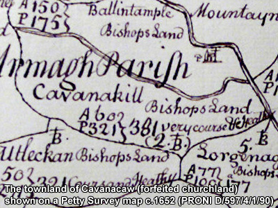
The townland of Cavanacaw is in the parish of Lisnadill in Armagh County. It is labelled number 15 on the map.
The Environment and Heritage Service Sites and Monuments Record (2002) notes the following in this townland:
"Kearney Hill", Rath of the Early Christian Period
SMR NO: ARM 012:023
GRIDREF: H88494276
CONDITION: SOME REMAINS
"To the NW of a small eminence, a small circular raised platform is marked on the OS 6” map of 1863, but all that now remains is a steep scarp, up to 1 m high, preserved below a curving hedge boundary on the N & NW sides. The interior now appears to be slightly domed and may have measured 30 - 35m across."
PRONI records: D.1201/1 (Incumbered estates rental, etc.); OS/6/2/12/1 (Surveyed 1835. Engraved 1835.); OS/6/2/12/2 (Surveyed 1835. Revised 1860. Engraved 1860 (Stat file copy).); OS/6/2/12/3 (Not Received.); OS/6/2/12/4 (Surveyed 1835. Revised 1905-06. Reprinted 1931-1947. Published 1931 with mss markings in red and stamped references 2566, 2567, 2573.); OS/6/2/12/5 (Surveyed 1906. Revised 1948. Levelled 1888 and 1906. Levels revised 1949. Published 1953. (2 copies) - 1 being reprint 1953, 56, 61).); OS/6/2/16/1 (Surveyed 1834-35. Engraved 1835.); OS/6/2/16/2 (Surveyed 1834-35. Engraved 1835. Revised 1860. Engraved 1862.); OS/6/2/16/3 (Surveyed 1834-35. Revised 1906. Levelled 1888-89 and 1906. Published 1908. Reprint 1952, 1954.); OS/6/2/16/4 (Surveyed 1834-35. Revised 1906. Levelled 1888-89 and 1906. Published 1908. Reprint 1929.); OS/6/2/16/5 (Surveyed 1834-35. Revised 1906. Levelled 1888-89 and 1906. Published 1908. Reprint 1952, 1954 with Mss. markings in red and stamped ref. 2568.); OS/6/2/16/6 (Surveyed 1906. Revised 1955. Levelled 1906. Published 1958. (2 copies).); VAL/12B/10/9A, VAL/12B/10/9B, VAL/12B/10/9C, VAL/12B/10/9D, VAL/12B/10/9E (Valuation annual revision list.); VAL/2B/2/8AC 1862 (Griffith valuation list.C 1862); VAL/1B/27 (1st Valuation Records.); D.266/357; D.1201/1/20 (Encumbered estates rental.13 Nov. 1855); VAL.2, p.284 (Rev. George Robinson.).
H905394