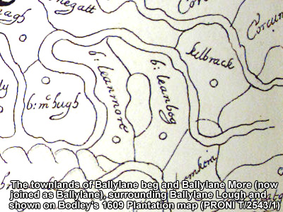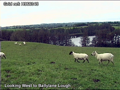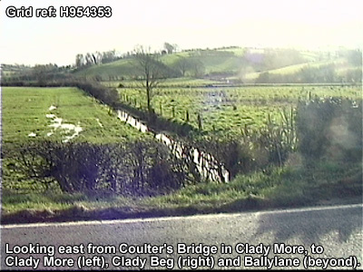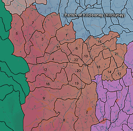
The townland of Ballylane is in the parish of Kilclooney in Armagh County. It is labelled number 2 on the map. The Mowhan River defines tthe boundary of the townland on its North and West sides, as shown on Bodley's 1609 plantation map below.
The Environment and Heritage Service Sites and Monuments Record (2002) notes the following in this townland:
Rath & ?Souterrain of the Early Christian Period.
SMR NO: ARM 021:033
Irish Grid Reference: H96303577
Townland: BALLYLANE
CONDITION: traces only
Field reports of 1960s describe a roughly circular earhwork 41m NW-SE x 42.5 NE-SW enclosed on SW & NE by a bank. Since then the SW bank has been levelled, while buildings have encroached on E. Only on the N & NE does the bank survive to any height. It stands 1.3m above the interior, & on the NE is c.3m above the outer ground level. The E half of the interior has been raised to counter the natural slope. The earlier reports mention a 3.6m wide ditch & a possible souterrain, but neither can now be located.
PRONI records: T.1827 (Testamentary papers of Leeper family.); OS/6/2/17/1 (Surveyed 1835. Engraved 1835.); OS/6/2/17/2 (Surveyed 1835. Engraved 1835. Revised 1860. Engraved 1863.); OS/6/2/17/3 (Surveyed 1835. Revised 1906. Published 1908. Reprinted 1929, 1932.); OS/6/2/17/4 (Surveyed 1906. Revised 1954-5. Levelled 1889, 1892 and 1906. Published 1958 (2 copies).); OS/6/2/21/1 (Surveyed 1834-35. Engraved 1835.); OS/6/2/21/2 (Surveyed 1834-35. Engraved 1835. Revised 1860. Revisions engraved 1863.); OS/6/2/21/3 (Surveyed 1834-35. Revised 1906. Published 1908. Reprinted 1921.); OS/6/2/21/4 (Surveyed 1834-35. Revised 1906. Published 1908. (2 copies), Reprints 1934-1957.); OS/6/2/21/5 (Surveyed 1906. Revised 1955. Levelled 1889 and 1906. Published 1958.); VAL/1B/210A, VAL/1B/210B, VAL/1B/240B (1st valuation records.); VAL/12B/10/13A, VAL/12B/10/13B, VAL/12B/10/13C, VAL/12B/10/13D (Valuation annual revision list.); VAL/2B/2/9A (Griffith valuation list.).