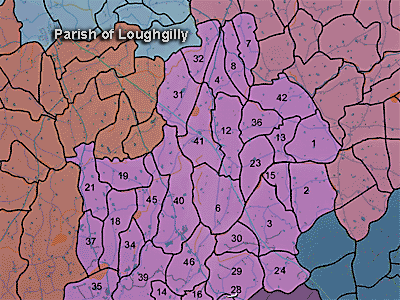
The townland of Ballenan is in the parish of Loughgilly in Armagh County. It is labelled number 1 on the map. J027372
The Environment and Heritage Service Sites and Monuments Record (2002) notes the following in this townland:
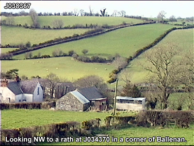
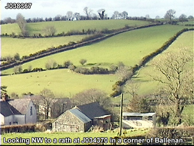
Rath of the Early Christian Period.
SMR NO: ARM 018:030
Irish Grid Reference: J03403697
Townland: BALLENAN
CONDITION: substantial remains
The site is relatively well preserved within an oval field & is 29m NW-SE x 35m NE-SW. It is enclosed on the vulnerable NW side by a bank 2m high above the interior. This becomes less prominent to NE & SW but as the natural ground level falls, the perimeter is defined by an increasingly steep scarp. It seems that the site has been partly dug into the hillslope on NW & the SE half has been raised. At SE the interior stands c.2m above ground level. A gap in the bank at W may be original.
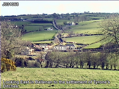
LINEAR EARTHWORKS of the Post-medieval Period
SMR NO: ARM 018:031
Irish Grid Reference: J03443687
Sitename: TYRONE'S DITCHES
Townland: BALLENAN
CONDITION: No visible remains
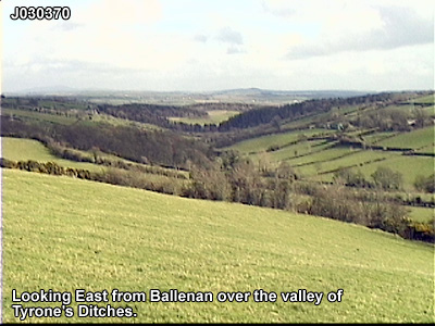
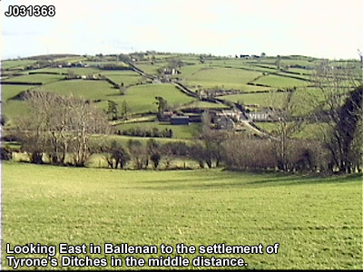
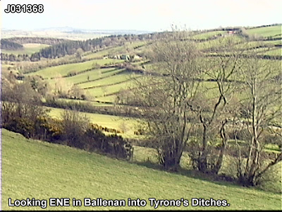
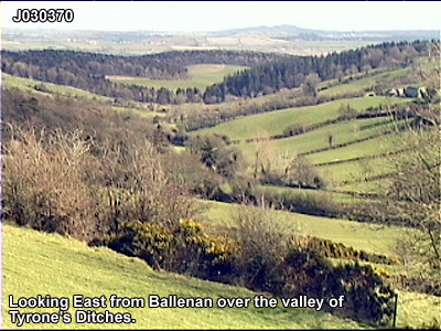
The feature marked on all editions of the OS 6" map as "Tyrone's Ditches" seemed in 1983 to be little more than a field division c.100m SE of a Rath [ARM 018:030]. It ran along the townland boundary, but the area has since been levelled & there are no visible remains. Bennet described ".. a ditch or trench cut by the Earl of Tyrone as a defence in the year 1660" Lewis recorded "... vestiges of the intrenchment surrounding the principal stronghold of the Earl of Tyrone during his wars with Elizabeth. "
BIBLIOGRAPHY:
LEWIS, S.1837, Vol. II, 472
O. S. FIELD REPORT NO.52, 12
O. S. MEM BALLYMORE: BENNET BOX 18, 2, 10
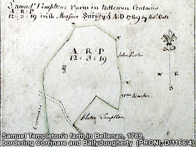
PRONI records: D.3533 (Account books of Rev. Alexander Savage, covenanting minister.); D.1166 (Title deeds re lands of Stewart family and map of Ballenan [1789].); MIC.38 (Session minutes, accounts, correspondence, etc., re Ballenan Reformed Presbyterian Church.); MIC.1C/16 (Records of Reformed Presbyterian Church.); MIC.1C/16 (Miscellaneous documents of Ballenan Reformed Presbyterian Church.); OS/6/2/17/1 (Surveyed 1835. Engraved 1835.); OS/6/2/17/2 (Surveyed 1835. Engraved 1835. Revised 1860. Engraved 1863.); OS/6/2/17/3 (Surveyed 1835. Revised 1906. Published 1908. Reprinted 1929, 1932.); OS/6/2/17/4 (Surveyed 1906. Revised 1954-5. Levelled 1889, 1892 and 1906. Published 1958 (2 copies).); OS/6/2/18/1 (Surveyed 1835. Engraved 1835.); OS/6/2/18/2 (Surveyed 1835. Engraved 1835. Revised 1860. Engraved 1863.); OS/6/2/18/3 (Surveyed 1835. Revised 1906. Published 1908.); OS/6/2/18/4 (Surveyed 1835. Revised 1906. Published 1908. (2 copies - 1st a reprint 1930, 1933 and 2nd reprint 1933, 1939, 1942, 1946, 1955.); OS/6/2/18/5 (Surveyed 1906. Revised 1954-5. Levelled 1892, 1901-2, 1904 and 1906. Published 1958 (2 copies).); OS/6/2/22/1 (Surveyed 1835. Engraved 1835.); OS/6/2/22/2 (Surveyed 1835. Engraved 1835. Revised 1861. Engraved 1863.); OS/6/2/22/3 (Surveyed 1835. Revised 1906. Published 1908 (2 copies - 1 reprint 1930 and 1 reprint 1930-1955.).); OS/6/2/22/4 (Surveyed 1906. Revised 1955. Levelled 1889 and 1906. Published 1959 (2 copies).); VAL/1B/219 (1st valuation records.); VAL/12B/15/10A, VAL/12B/15/23A, VAL/12B/15/23B, VAL/12B/15/23C, VAL/12B/15/23D, VAL/12B/15/23E (Valuation annual revision list.); VAL/2B/2/34C (Griffith valuation list.).
In the accompanying audio recording, Dr. Neil McGleenon, retired headmaster and local historian, talks about the local area known as Tyrones Ditches, Hugh O'Neill and Creaghts in the period of the Nine Years War at the end of the reign of Queen Elizabeth I.
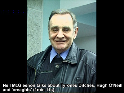
Use the audio controller to listen to this talk, given in 2003.