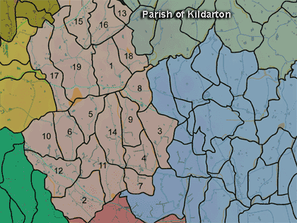
The townland of Altaturk is in the parish of Kildarton in Armagh County. It is labelled number 1 on the map. (H922455)
The Environment and Heritage Service Sites and Monuments Record (2002) notes the following in this townland:
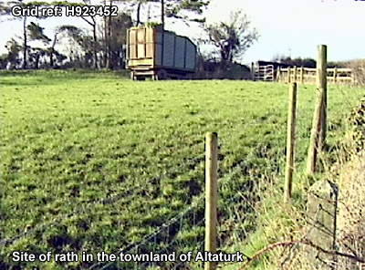
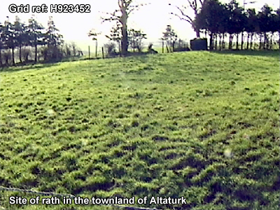
"Allen's Field Forth" or "Allen's Forth", an enclosure
of uncertain period.
SMR NO: ARM 012:075
GRIDREF: H9245
CONDITION: NO VISIBLE REMAINS
Not precisely located.
BIBLIOGRAPHY: PATERSON, T.G.F. NOTES VOL.135
Paterson (Armachiana, Vol. 16, p.21) notes:
PRONI records: T.387 (Rent roll of Earl of Charlemont estate.); OS/6/2/12/1 (Surveyed 1835. Engraved 1835.); OS/6/2/12/2 (Surveyed 1835. Revised 1860. Engraved 1860 (Stat file copy).); OS/6/2/12/3 (Not Received.); OS/6/2/12/4 (Surveyed 1835. Revised 1905-06. Reprinted 1931-1947. Published 1931 with mss markings in red and stamped references 2566, 2567, 2573.); OS/6/2/12/5 (Surveyed 1906. Revised 1948. Levelled 1888 and 1906. Levels revised 1949. Published 1953. (2 copies) - 1 being reprint 1953, 56, 61).); OS/6/2/13/1 (Surveyed 1834-35. Engraved 1835.); OS/6/2/13/2 (Surveyed 1834-35. Revised 1860. Engraved 1863 (Stat file copy).); OS/6/2/13/3 (Surveyed 1834-35. Revised 1905-06. Published 1930.); OS/6/2/13/4 (Surveyed 1905-06. Revised 1954-55. Levelled 1888 and 1892 and 1902, 1905-1906. Levels part revised 1948. Published 1958. (2 copies).); VAL/1B/230 (1st valuation records.); VAL/12B/10/25A, VAL/12B/10/25B, VAL/12B/10/25C, VAL/12B/10/25D, VAL/12B/10/25E (Valuation annual revision list.); VAL/2B/2/28C (Griffith valuation list.).