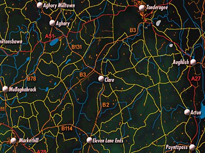
Population: 2650 in 1991, 2382 in 1981, 1725 in 1971. It is 9.6 km from Markethill, to the North East. The old spellings of Tandragee were Tanderagee and Tonagree. (The townland of Tanderagee is another place, South West of Markethill.)
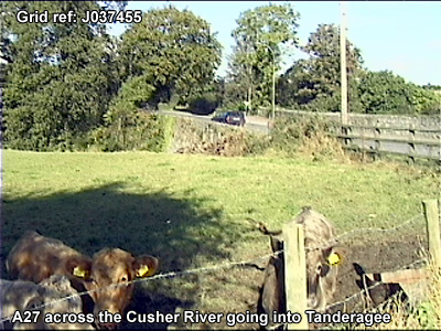
"The town in situated on the main Portadown-Newry (A27) Road approximately five miles from Portadown and nine miles from Armagh. With a fairly diversified industrial base, it provides a good deal of local employment in such activities as potato processing, textile manufacture and flour milling. It also functions as a service centre for its local hinterland and a dormitory town for residents working elsewhere." (Armagh Area Plan 2004: Armagh District Council Area)
McKay, P A Dictionary of Ulster Place-names (Belfast, 1999) notes:
Parish of Ballymore, Barony of Orior Lower
From the Irish Toin re Gaoith 'Backside to the wind'. There are hills so named throughout Ireland, no doubt on account of their exposed situations. Tandragee is mainly in the townland of Ballymore.
(T—in re Gaoith, 1642)
The town was described in 1838 in the Ordnance Survey Memoirs:
"The towns contained in the parish [of Ballymore] are Tanderagee, Poyntzpass
and Acton. The principal of these, Tanderagee, is situated in the diocese
of Armagh, province of Ulster, county of Armagh, parish of Ballymore and north
east circuit of assize, on the road between Portadown and Newry, at the distance
of 5 and a quarter statute miles from the former and 12 and a quarter statute
miles from the latter. Distance from Dublin 61 Irish miles, latitude north
[blank], longitude west [blank]. The following are its distances from the
neighbouring towns in English or statute miles: east of Armagh 10 miles, north
by west from Newry 12 and a quarter miles, north east of Markethill 6 miles,
east south east of Rich Hill 5 and a half miles, south by east of Portadown
5 and a quarter miles.
"Streets
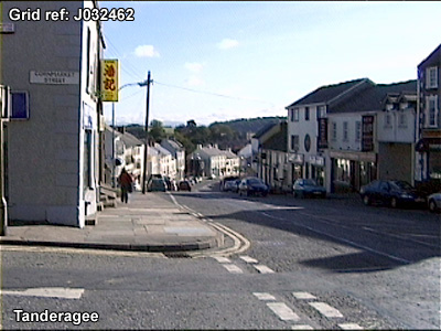
"The town consists of 3 streets, the continuation of one another: Church
Street, running in a direction north north east 220 yards, Market Street,
in a direction north west and south east 285 yards, Mill Street, in a direction
south by east 310 yards, the total length of the town being 815 yards. The
town is built in the townland of Ballymore on the slopeof a hill called Tanderagee
hill. The descent from the church, which is situated near the northern extremity
of the town, to the mill dam at its lower extremity is very steep, the fall
being 126 feet, i.e. from 238 feet to 112 feet above the level of the sea,
the breadth varying from 100 to 20 feet.
"Public Buildings
"The principal buildings contained in the town are the church, 2 Methodist
meeting houses and 5 schoolhouses and Tanderagee Castle, I police station,
2 banks. Houses: Tanderagee The greater number of the houses in Tanderagee
are in good order. The following is their number: 46 3-storey houses, 133
2-storey houses, 57 cabins and 1-storey, 236 total number of houses. They
are, with the exception of 2 brick houses, built of unhewn stone and covered
with plaster and roughcast. With the exception of Church Street the town presents
a uniform appearance.
"Trades and Occupations
"Surgeons 3, grocers 17, haberdashers 8, spirit dealers 36, painters
and glaziers 1, bakers 3, tailors 2, shoemakers 6, watchmakers 2, hardware
shops 2, earthenware shops 2, leather stores 2, saddlers 3, nailors 1, tinsmiths
1, smiths 1, reedmakers 1, pawnbroker 1.
"Religious Libraries
"There is a lending library in the Castle, Tanderagee, for the use of
the gentry and shopkeepers, and one in each of the schools on Lord Mandeville's
property for the use of the poor. The books of which they consist are all
religious.
"Banks
"There are in the town of Tanderagee 2 branch banks, one of the Ulster
Banking Company and one of the Belfast Banking Company, the offices of which
are open every day from 10 a.m. to 4 p.m. " (Ordnance
Survey Memoirs 1835-38)
In 1838:
"There are no funds or bequests for the relief of the poor in Tanderagee. They are supported by private subscription and also relieved by the following means: a fever hospital supported by private subscription and also by fines from the petty sessions. Four small houses are given rent free by Lady Mandeville for the habitation of 8 widows, 2 to reside in each house; 20 widows and other destitute persons receive a portion of meal weekly at the Castle, and in general the poor are very carefully supported by Lord and Lady Mandeville. There is also a clothing store at the Castle for supplying the tenants at cost price, the clothing being made in the schools" (Ordnance Survey Memoirs 1835-38)