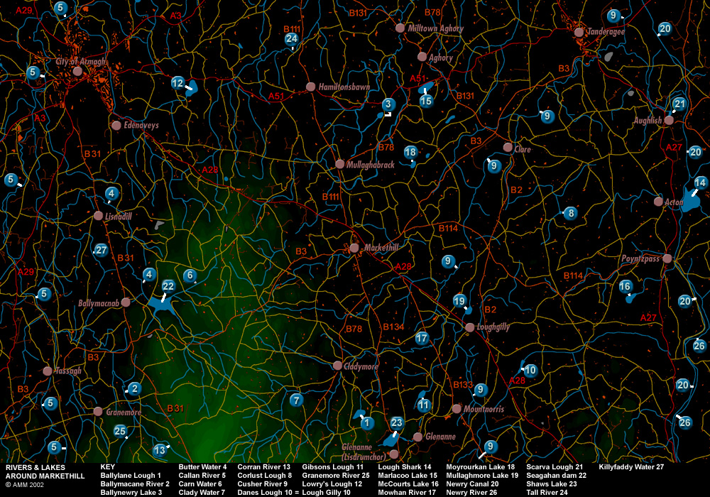
Rivers, streams, lakes and dams are important features of the landscape, draining parts and irrigating others. In early times, they offered food and afforded protection. They were both means of transport and obstacles to movement. Generally, their sizes and positions have altered very little over the centuries. They are ever changing and ever the same to passing generations. They are also important in defining land divisions. You will notice on the old maps in the Maps section that rivers and streams often separate townlands. A river, lake or stream is a natural boundary and obstacle to livestock roaming: where a river or lake or stream marks the boundary of your pasture land, you do not have to build a wall or plant a hedge to stop cattle or sheep going into someone else's land.
There are many streams and rivulets that have not been noted in this section. Each will have a local name that varies according to the townland it meanders through or around. Even locally, the same river, stream or lake may be known by different names by different people and the names can vary through time.
Click on the map to view the image at full resolution.