Update commissioned by Markethill District Enterprises Limited
Executive producer: Alison Strong
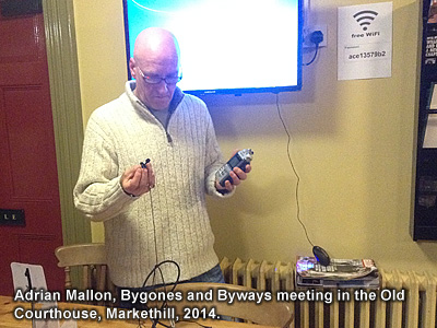
Program consultancy, design, development and additional research: Dr Adrian Mallon
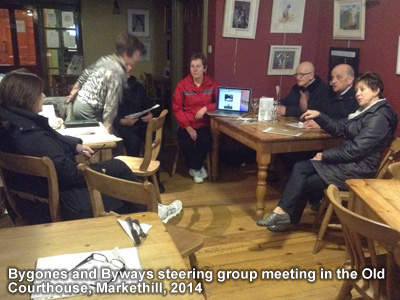
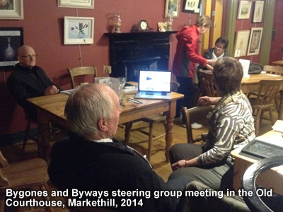
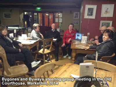
Project steering group:
Mr Willie Johnston,
Mr Joseph Canning,
Mrs Alison Strong,
Mr Edwin McWilliams,
Mrs Ruth Caddell,
Mrs Betty Stewart,
Mrs Ita Crossan,
Mrs Mary Loughran.
Additional text content: © (copyright) Markethill District Enterprises Limited 2014
Additional software, graphics, design, photos and sound recordings: © (copyright) Adrian Mallon Multimedia, 2014
Project funded by
SOAR (Southern Organisation for Action in Rural Areas)
Markethill District Enterprises Limited.
For recent recordings in particular, thanks go to Betty Stewart, Colin Lowry, Edwin McWilliams, Elaine Cullen & Emma Gribben of SOAR, Frank McWhirter, Hampton Hewitt, James Magowan, Joe Love, Linda McMahon, Mary Loughran, Noel Dalgleish, Richard Dougan, Richard Hunter, Sam Hetherington, Tatjana Nikolajeva, Tommy Wallace and Trevor Dalzell. Joseph Canning contributed an article about the military service of people from the area in WW1 (very topical in the 2014 centenary year) and James Magowan's sister, Rachel, contributed an article on her grandfather, Sir John Hall Magowan of Mountnorris, who also fought in WW1. There are many more contributions, also, for which we're grateful, many by members of the project steering group.
In the accompanying recording, Elaine Cullen, Craigavon Borough Council Programme Manager for the Southern Organisation for Action in Rural Areas (SOAR) programme, talks about SOAR and rural development project funding.
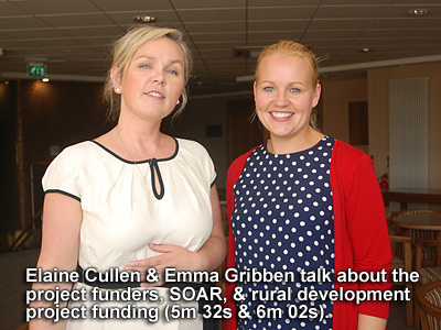
Use the audio controller to listen to this talk, given in September 2013.
Listen also to the recording of Emma Gribben, Armagh City & District Couci Project Officer for SOAR, who also talks about SOAR and the Bygones and Byways project update funding.
Use the audio controller to listen to this talk, given in September 2013.
Program commissioned by Markethill District Enterprises Limited
Executive producer: Audrey Kerr
Program consultancy, design, development and additional research: Dr Adrian Mallon
Historical research: Lesley Campbell
Project working group:
Text content: © (copyright) Markethill District Enterprises Limited 2003
Software, graphics, design, photos and sound recordings: © (copyright) Adrian Mallon Multimedia, 2003
Project funded by
the Heritage Lottery Fund,
the Rural Development Council,
Markethill District Enterprises Ltd.
In many respects, this is a ground-breaking project but the most important contribution to its success has been the input from local people and professional experts (often the two sets overlapping). We gratefully acknowledge the contributions of the working group named above and also
Mrs Helen Hunter, Markethill District Enterprises Limited,
Dr Roger Strong, Miss Valerie Adams and Dr Gerry Slater of the Public Record Office in Belfast,
Ken Neil, Senior Inspector for Sites and Monuments, the Environment and Heritage Service, Belfast,
Dr Greer Ramsay, Deputy Curator, Armagh County Museum,
Robin Alexander, for permission to use his track on the Bawn CD as our introductory music,
Nora Allen of Markethill,
Miss Sally Clarke of Armaghbrague, Cladymore and Markethill,
Patricia Daly of Magherydogherty and her Harp School,
Fiddle Steeks fiddle orchestra in Markethill,
Jean Clarke and Gosford Friendship Club,
Billy and Rachel Henry of Loughgilly,
the Reverend Kennedy, Church of Ireland rector of Kildarton and Lisnadill,
Rosaleen Kerr of Mullabrack House,
John Lund at Jacquards Textiles, Glenanne,
Dawson Jones and Jenny Maguire of Mullaghbrack, of the Forest Service at Gosford,
Seamus Mallon of Coolmillish, Member of Parliament for Newry and South Armagh,
the Reverend Mattison, Presbyterian minister of Cremore,
Jack McCune of Glasdrummond,
Myrtle McGuinness, Development Officer for Mid-Armagh Community Network
John McGrath of Markethill,
Joey McStay of Mullaghbrack,
Edwin McWilliams, Markethill,
John Mitchell of Ballylane,
Billy Pielow, Armagh,
Sam and Isobel Qua of Mountnorris,
the Reverend Daniel Rankin, minister for Markethill First and Second Presbyterian Churches,
Michael Smallman and Deirdre Wildy, Humanities and Special Collections Librarian, Queen's University Library, Belfast,
Margaret Watson, Markethill,
Ronnie West, secretary of the History Society,
Roisin White who sings "Gosford's Fair Demesne",
John Magowan of Mountnorris,
Primrose Wilson, Marlacoo House, Marlacoo Beg,
Ivan Walker, Chairman of Kilcluney Flute Band,
Killeen Pipe Band,
Pearl Marshall, Ivy Sterritt, Agnes Crozier and Reatha Hassan of Saver & Naver,
Mary McVeigh, Senior Librarian, SELB Irish and Local Studies Library, Armagh,
Carol Conlon, Deputy Keeper, Robinson Library, Armagh,
Ruth Jenkins and P7 pupils of Markethill Primary School,
David Alexander, Glenanne House, Lower Lisdrumchor,
Mavis and Alison Crozier of Drumconwell,
the Reverend Neville Hughes, Mullabrack Church of Ireland,
Gerard McNally, Armagh Computer World, who supplied the touchscreen computer systems,
Brian Bailie of Ballywalter who built the touchscreen cabinets and wall panels,
Edgar Hunter, Corhammock,
Finally, thank you, the members of Markethill and District community who contributed, and continue to contribute, information, old photographs and advice.
Except where otherwise stated, all text information is copyright Markethill District Enterprises Limited 2003, 2014.
Except where otherwise stated, all software, design, graphics, photos and sound recording elements are copyright Adrian Mallon Multimedia 2003, 2014.
The introductory music to the 2003 CD-ROM is copyright Robin Alexander.
Many thanks to the Public Record Office Northern Ireland for permission to reproduce the following which are Crown Copyright:
Thanks to Queen's University Belfast for permission to reproduce the following which are copyright Queen's University Belfast:
1567 Hibernia insula non procul ab Anglia vulgare Hirlandia vocata 1567 [by] Jo: Goghe; Facsimile of a ... [manuscript] map ... [in the Public Record Office] shewing the territories of the Irish Princes and chiefs, the various septs subordinate to them etc, also the districts in possession of the English lords, their armorial bearings, etc; Scale: [c.1=1,000,000] 16 miles = 1"/ (40x52 cm); Cartographer/Engraver: John Gough. Additions in the hand of Sir William Cecil, Lord Burleigh; Publication details: Dublin: W.B. Kelly, 1874; Facsimile of S.P. 64/1/1; MPF 68; Coloured; QUB Ewart A 1567
1570 c. 1570; Map of Ireland, with the names of the great proprietors; Scale: No scale. On 2 sheets each 11"x8"; Cartographer/Engraver: Nowell, Laurence (Dean of Lichfield); Publication details: Photocopy of MSS map in the British Library; [London]: Topographical Department, War Office [Sir H. James was Director at the time]. Lithographed and printed under the direction of Major A.C. Cooke R.E.; QUB Ewart A 1570 (I, ii)
1572. Eryn. Hiberniae Britannicae insulae nova description. Irlandt; Scale: [c. 1:900,000] 141/2 miles = 1"/ (34x46 cm); Cartographer/Engraver: Abraham Ortelius; Publication details: [Antverpiae]; From Theatrum orbis terrarium. Additamentum. [?1573 or later ] (Latin text); Coloured; QUB Ewart A 1572
1595 [?1595 or post]; Irlandiae regnum; Scale: 151/2 Irish miles = 1" (31x39 cm); Cartographer/Engraver: Gerhard Mercator; Publication details: [Amsterdam]; From Mercator's Atlas sive ... cosmographicae meditations, 1595 (Latin text); QUB Ewart A 1595
1599 [1599]; Irelande. In this generall description or chart ... particularlye is showne ... the division ... of the 4 provinces ... also the division of everi countrye ... Varonies lordes names & countrie; Scale: 73/4 Irish miles = 1"/ (52x82); Cartographer/Engraver: Battista Boazio/ Renold Elstrack; Publication details: [London]: Emery Walker [1938]; Facsimile of British Library copy (Maps C2.c01) of original published by Sudbury 1599; Coloured; QUB Ewart A 1599
1609-11 [c. 1610]; [a plot of Ireland with the confines]; Copy map of Ireland ... Preserved in State Paper Office, London; Scale: [c.1:570,000] 9 miles = 1"; 30 miles= 33/8 inches/ (43x77 cm); Cartographer/Engraver: Norden, John; Publication details: Sealy, Bryers and Walker, Litho. Dublin; Facsimile of SP64/3; MPF 67; QUB Ewart A 1609/11 (tinted)
1610 (i) Hiberniae Ireland Anglis.; Yverdon Britannis Erin incolis; Scale: 181/2 miles = 1"/ (26x33 cm); Cartographer/Engraver: Gerhard Mercator/William Hole; Publication details: [London: G. Bishop & J. Norden]; From W. Camden's Britain, 1610; Coloured; QUB Ewart A 1610
1635 [1635 or post]; Hibernia regnum vulgo Ireland; Scale: 13 Irish miles = 1" (36x48 cm); Cartographer/Engraver: [Copied from Speed]/Willem Janszoon Blaeu; Publication details: [Amsterdam]: Apud Guiljelmum Blaeu; From Blaeu's Toonneel des aerdrycx ofte nieuwe atlas, 1635; Coloured; QUB Ewart A 1635
1673 [1673]; A mapp of the kingdome of Ireland; Scale: [c. 1:850,000] 131/2 miles = 1"/ (36x39 cm); Cartographer/Engraver: Richard Blome (based on Speed)/R. Palmer; Publication: [London: Tho. Roycroft]; From Britannia; or, A geographical description of the kingdoms of England, Scotland and Ireland; Coloured; QUB Ewart A 1673
1680 [c. 1680]; Regnum Hiberniae divisuum in quatuor partes ... quae et sunt divisae in omnes suos comitatus; Scale: [c. 1:750,000] 12 miles = 1" (57x47 cm); Cartographer/Engraver: Frederick de Wit (based on Speed); Publication details: Amstelodami: apud Fredericum de Wit; Coloured; QUB Ewart A 1680
1695 (i) [1695]; The kingdom of Ireland; Scale: [c. 1:900,000] 141/2 miles=1"/ (40x33 cm); Cartographer/Engraver: Robert Morden; into English, 1695; QUB Ewart A 1695
(ii) [c. 1695]; Hiberniae regnum tam in praecipuas Ultoniae, Connaciae, Lageniae, et Momoniae, quam in minores earundem provincias, et ditiones subjacentes peraccuratŽ divisum; Scale: [c. 1:800,000] 121/2 miles = 1"/ (54x46 cm); Cartographer/Engraver: Nicholas Visscher; Publication details: [?Amsterdam]; Coloured; QUB Ewart A 1695
1700 [c. 1700]; Novissima ac prae caeteris aliis accuratissima regni et insulae Hiberniae delineatio ... in triginta duos comitatus qui et sunt divisi in omnes subjacentes baronnatus; Scale: [c. 1:500,000] 71/2 miles = 1"/(70x49 cm); Cartographer/Engraver: Frederick de Wit; Publication details: Amstelodami; Coloured; QUB Ewart A 1700
1714 [i.e. c. 1717]; A new map of Ireland divided into its provinces, counties and baronies, wherein are distinguished the bishopricks, borroughs, barracks, bogs, passes, bridges &c. with the principal roads, and the common reputed miles; Scale: [c. 1:500,000] 8 miles = 1"/ (100x59 cm); Cartographer/Engraver: Herman Moll; Publication details: [London] for H.Moll ... D.Midwinter ... P. Overton ... and T. Bowles; From The world described, [c.1717]; Coloured; QUB Ewart A 1714 (1717)
1720 A new map of Ireland from the latest observations; Scale: [c. 1:730,000] 111/2 miles = 1"/ (56x47cm); Cartographer/Engraver: John Senex; Publication details: [London: D. Browne]; From A new general atlas of the world, 1721; Coloured; QUB Ewart A 1720
1725 1714 [i.e. c.1725]; A new map of Ireland divided into its provinces, counties and baronies wherein are distinguished the bishopricks, borroughs, barracks, bogs, passes, bridges etc; Scale: [c. 1:500,000] 8 miles = 1"; 30 miles = 37/8 inches (100x59 cm); Cartographer/Engraver: Moll, Herman with Ňall the improvements of Hen: Pratt".; Publication details: [London]: for H. Moll ... I. Bowles ... P. Overton ... and T. Bowles. And by I. King
From The world described [c. 1725]; QUB Ewart A 1714 (1725) in 2 sheets
1735 [c. 1735]; Hyberniae regni et provincias Ultoniam, Connacham, Lageniam, Monomiamq. divisi tabula accuratissima editore; Scale: [c. 1:750,000] 12 miles = 1"/ (57x48 cm); Cartographer/Engraver: J. Covens & C. Mortier; Publication details: t'Amsterdam, by I. Covens en C. Mortier; Coloured; QUB Ewart A 1735
1595 [c. 1595 or post]; Ultoniae orientalis pars; Scale: 5 Irish miles = 1"/ (33x 36 cm); Cartographer: Gerhard Mercator; Publication details: [Amsterdam]; From Mercator's Atlas sive ... cosmographiae meditations, 1595 (Latin text); Coloured; QUB Ewart B 1595
1638 [1638 or post]; Provincia Ultoniae The province of Ulster; Scale: 72/3 miles = 1" /(36x47 cm); Cartographer: J. Jansson; Publication details: Amstelodami: Apud Joannem Janssonium; [From his Novus Atlas]; Coloured; Ewart B 1638
1646 [1646 or post]; Provincia Ultoniae. The Province of Ulster; Scale: 72/3 miles = 1" /(36x47 cm); Cartographer: J. Jansson; Publication details: Amstelodami: Apud Joannem Janssonium; From his Novus Atlas; Coloured; Ewart B 1646
Ordnance Survey memoirs for Ballymore, Kilclooney, Loughgilly and Mullaghbrack parishes in Day, A., and McWilliams, P., eds., Ordnance Survey Memoirs of Ireland: Parishes of County Armagh 1835-8. Vol. 1. (1990).
Permission to reproduce the two Vallely paintings of bullet-throwers and fiddlers, which hang in the foyer of Queens University at Armagh.
Many thanks to Eoin Magennis, secretary, Séanchas Ard Mhacha and to Neil McGleenon for permission to reproduce the following:
Many thanks to the Environment and Heritage Service Northern Ireland for permission to reproduce the following which are Crown Copyright:
Many thanks to Armagh County Museum (National Museums and Galleries of Northern Ireland) for permission to reproduce the notes and writings of T. G. F. Paterson and to photograph within the museum.